Drone photos for precise PV planning
Precise PV planning with professional drone photos and 3D models. Centimeter-accurate orthomaps and photogrammetry for error-free module assignment. Create digital planning principles now.

How do drone photos work with autarc?
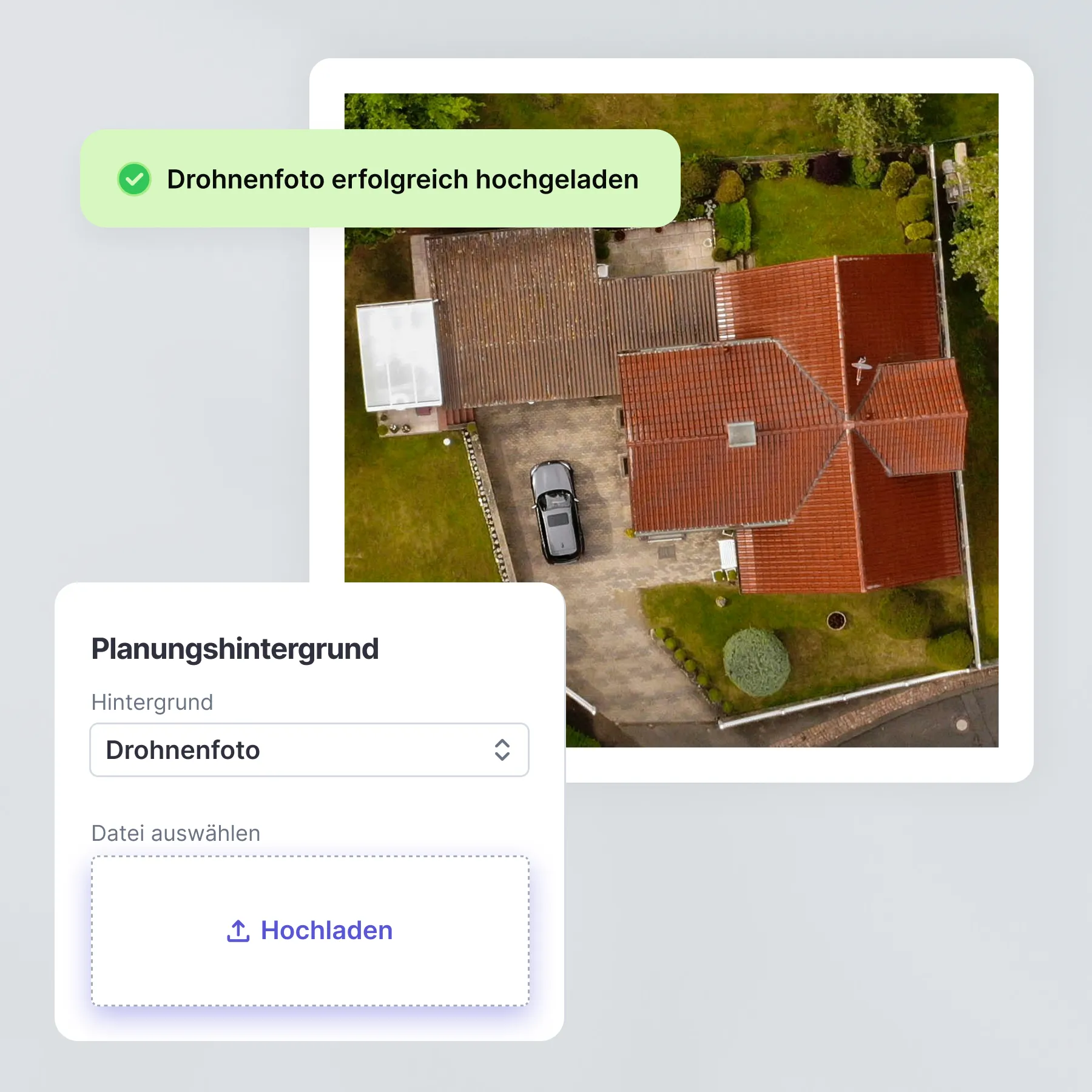
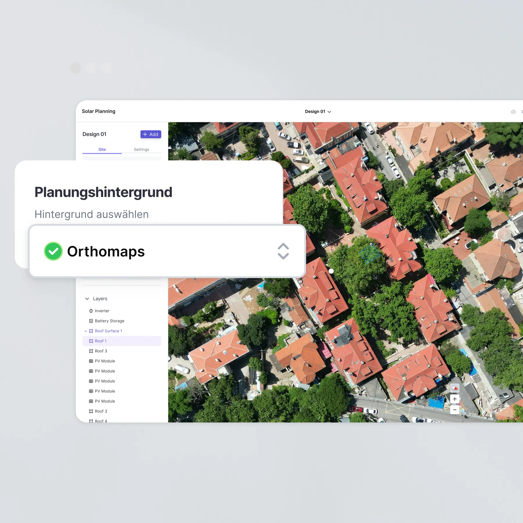
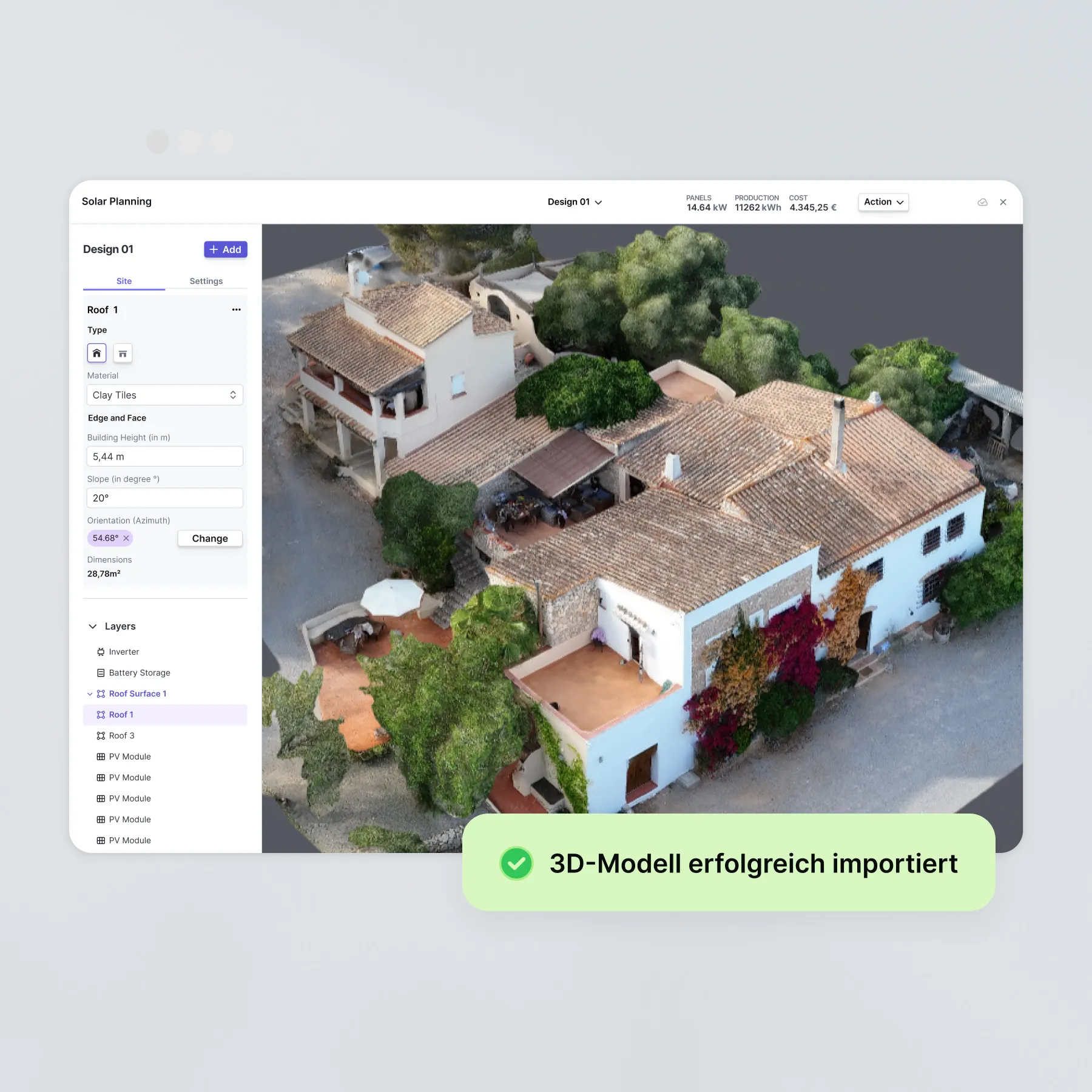
You will receive professional drone footage for your PV projects. Our photogrammetry creates precise 3D models from 75 to 300 photos. They plan directly in the digital twin or use distortion-free orthomaps. It only takes 10 to 20 minutes to record on site.
- Step 1: Drone footage on site
- Step 2: Photogrammetry processing to 3D model
- Step 3: Precise planning in 2D or 3D
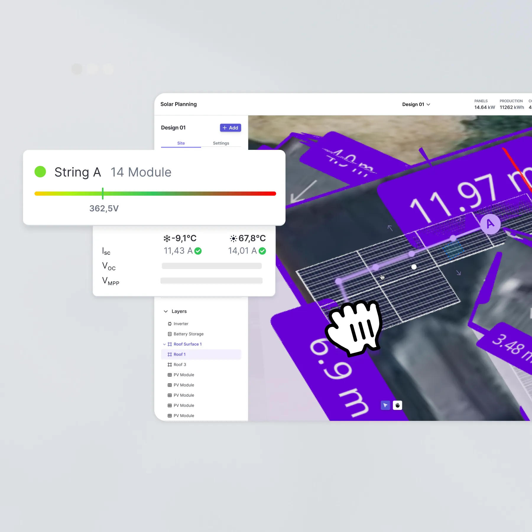
- Step 4: Error-free module assignment and string planning
Which features are included?
Benefits of drone photos with autarc
- Precision down to the centimeter: 3D models completely eliminate planning errors
- Quick recordings: Only 10 to 20 minutes on site for complete data collection
- Distortion-free orthomaps: 20 cm ground resolution available for all of Germany
- One-stop shop: From recording to finished planning, everything from a single source
- Flexible planning options: Plan either in 2D orthomaps or 3D models
- Professional quality: photogrammetry standard for maximum planning accuracy
Rates

FAQ about drone photos
How long does a drone recording take on site?
What is the accuracy of the 3D models?
Can I use my own drone photos?
What is the resolution of the orthomaps?
Are orthomaps available for the whole of Germany?
What planning options does the 3D model offer?
What are drone photos?
Drone photos are high-resolution aerial photos. autarc uses them for PV planning. Photogrammetry allows you to create distortion-free orthomaps and 3D models. With 75 to 300 individual images, planning principles are created with centimeter accuracy. They enable precise module assignment and string planning without measurement errors.