Photogrammetry: 3D surveying by drone
Create precise 3D models from drone photos. For digital planning and exact area determination. Photogrammetry is integrated into the software for fast PV planning, eliminating the need for manual measurements.

Precise measurement from images
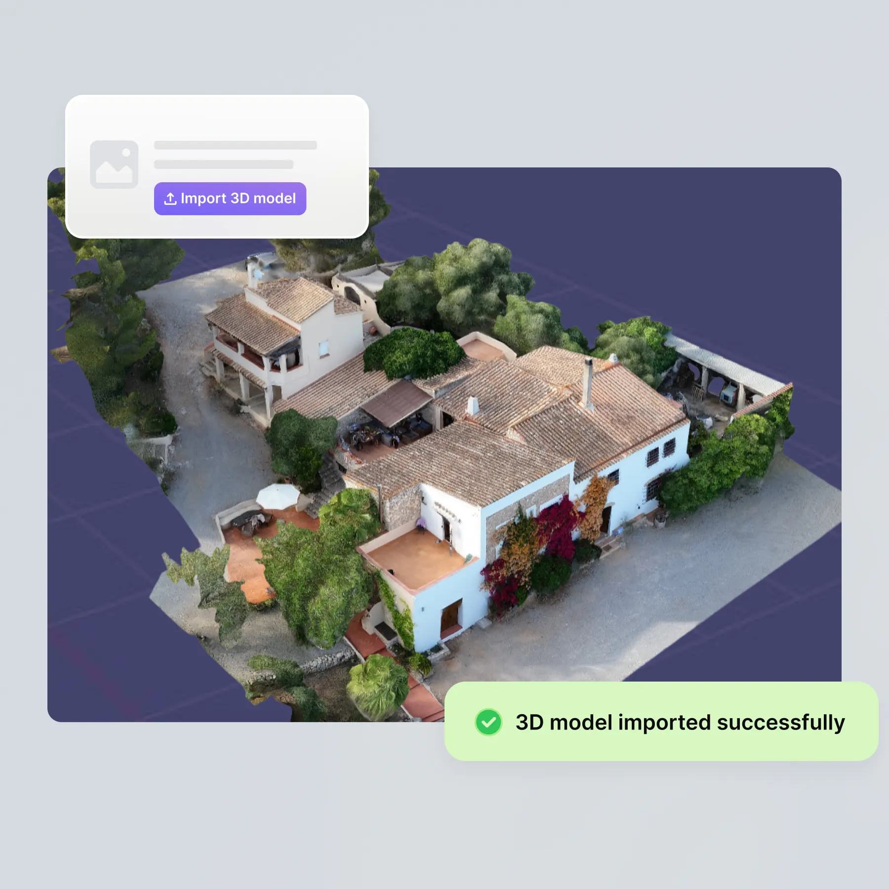
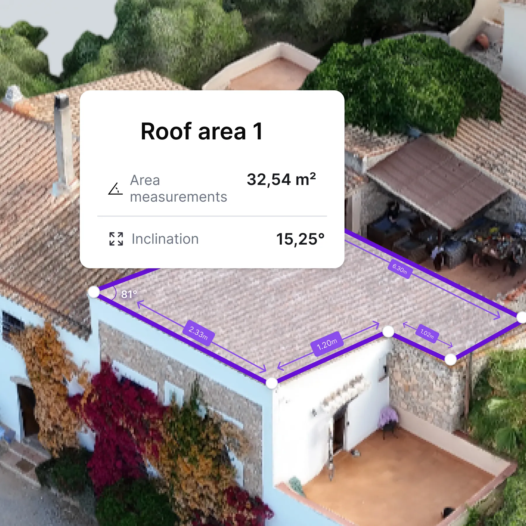
The autarc photogrammetry function automatically converts drone or cell phone photos into a complete 3D model. This means that manual measurement on the construction site is no longer necessary.
- Step 1: Carry out drone flight
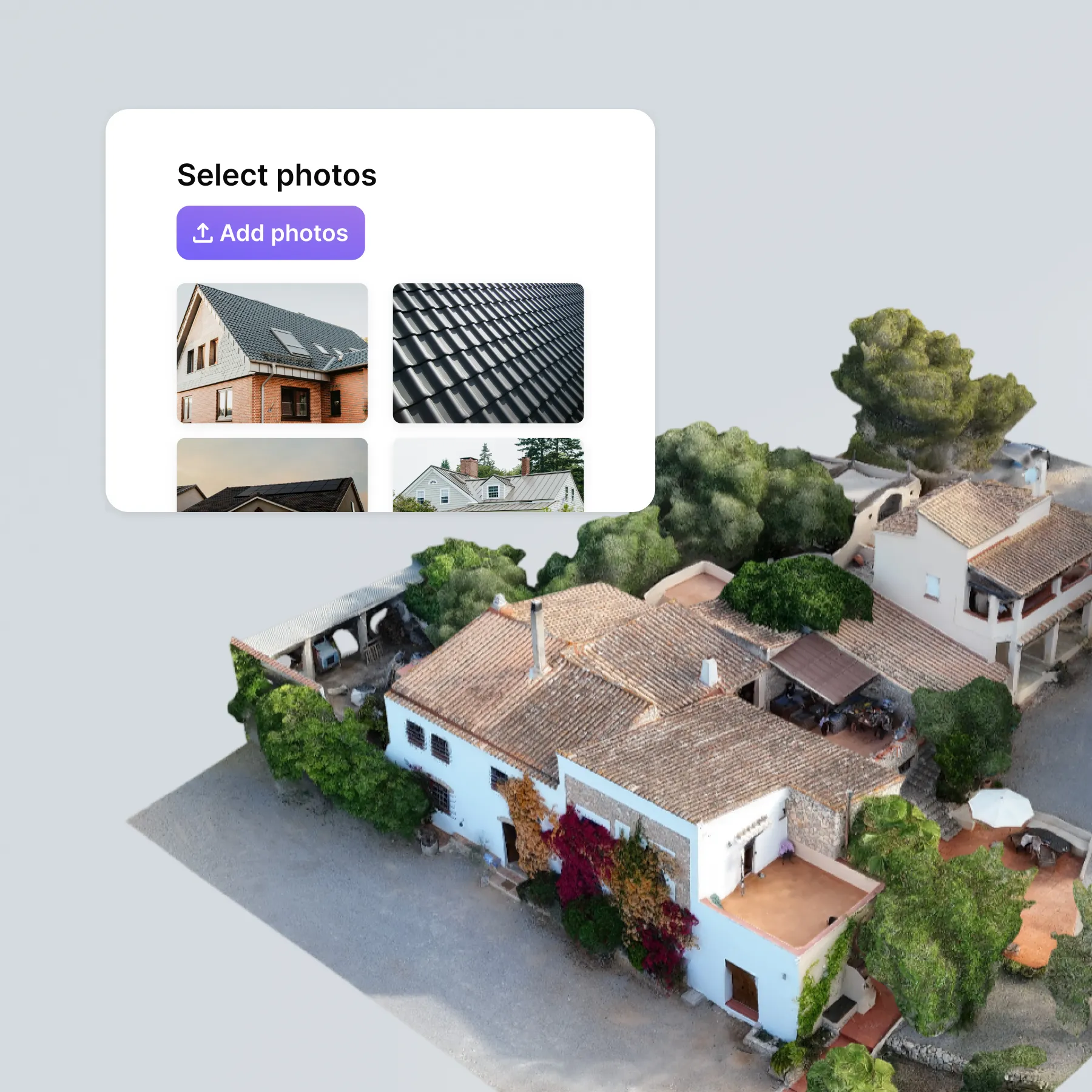
- Step 2: Upload photos
- Step 3: Receive 3D model
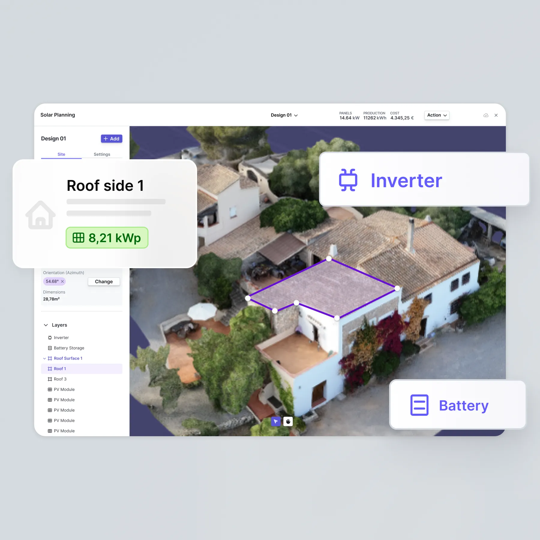
- Step 4: Plan PV system with autarc
That's what you can expect
Why you should use photogrammetry with autarc
- Everything from a single source: you don't need any additional software. The 3D model lands directly in autarc.
- Maximum safety: No more climbing onto the roof. No risk of accidents for your team.
- Precision to the centimetre: Measurement accuracy of 5 to 10 cm for reliable planning.
- Enormous time saving: 10-minute drone flight instead of hours of measuring.
- Professional impression: Impress customers with modern 3D visualisation.
- Seamless integration: Direct further use in PV planning without detours.

Rates
Photogrammetry FAQ
Which photos do I need for photogrammetry?
Can I edit the model?
Can I also use the 3D model outside autarc?
How long does it take to process my drone photos?
What does photogrammetry with autarc cost?
Do I need a special drone licence for surveying?
What is photogrammetry and how is it used?
Photogrammetry is a digital measurement method in which a three-dimensional model of an object is created from several photos. In buildings, this makes it possible to precisely record the shape, area and structure of a roof or façade. With autarc, you can use this technology to generate a digital 3D model from just a few images, which is directly incorporated into your PV planning or heating load calculation. This increases accuracy and saves time during on-site recording.