Shading analysis for PV systems
autarc offers precise shading analysis using 3D drone models. Shadow losses are automatically included. In this way, you can optimize your PV planning and maximize yield.

How does shading analysis work with autarc?

autarc uses real 3D drone models for precise shading simulations. You upload your drone photos and receive a detailed analysis of all sources of shade. The system calculates shadow losses at module and string level. In this way, you can find the optimal module layout and compare different planning variants. The analysis is carried out automatically and provides immediately usable results.
- Step 1: Upload drone photos
- Step 2: Generate 3D model
- Step 3: Simulate shading
- Step 4: Analyze results
Which features are included?


Benefits of shading analysis with autarc
- Precise 3D simulation: for millimetre-accurate shading calculation using high-resolution drone models
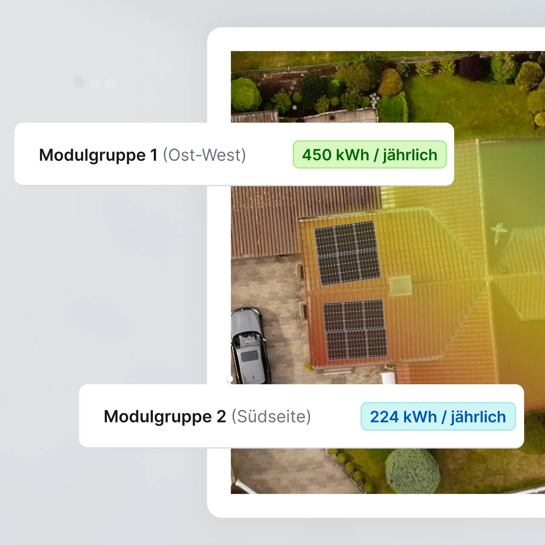
- Module-level analysis: shadow losses of each individual module can be seen in detail
- String optimization: Find the optimal string configuration for maximum yield
- Comparison of variants: compare different module assignments quickly and easily
- Automatic calculation: immediate results without manual post-processing
- Professional reports: detailed documentation for customer presentations

Rates
What is shading analysis?
A shading analysis evaluates the shading effect on photovoltaic modules caused by objects such as trees or buildings. It shows you exactly which modules are being shaded and when. The result: You find the optimal module layout and can maximize the yield of your PV system. The analysis takes into account horizon shading and object shading at module and string levels.
FAQ on shading analysis
How accurate is shading analysis using 3D drone models?
Which types of shading are taken into account?
Can I compare different module assignments?
How long does a shading analysis take?
Are shadow losses shown at module level?
Is shading analysis suitable for all roof shapes?