Services
Photogrammetry: 3D surveying by drone
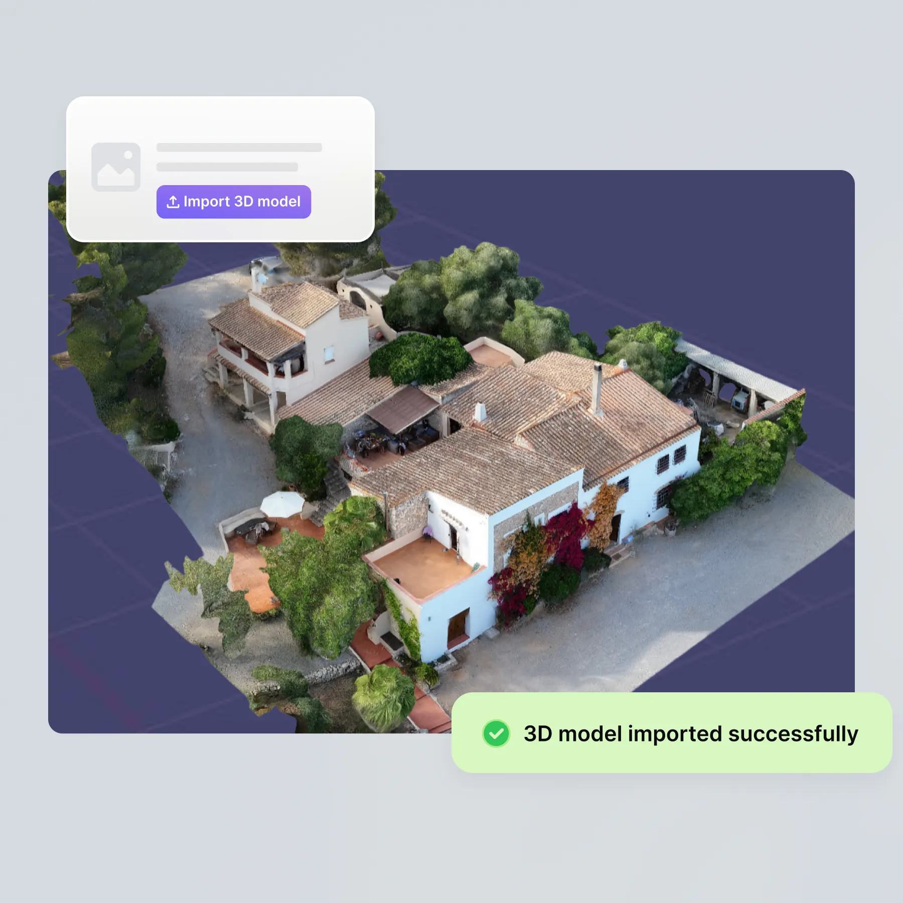
Create precise 3D models from drone photos. For digital planning and exact area determination. Photogrammetry is integrated into the software for fast PV planning, eliminating the need for manual measurements.
Thank you! Your submission has been received!
Oops! Something went wrong while submitting the form.
Tailored in 3D
drone photos

Planning
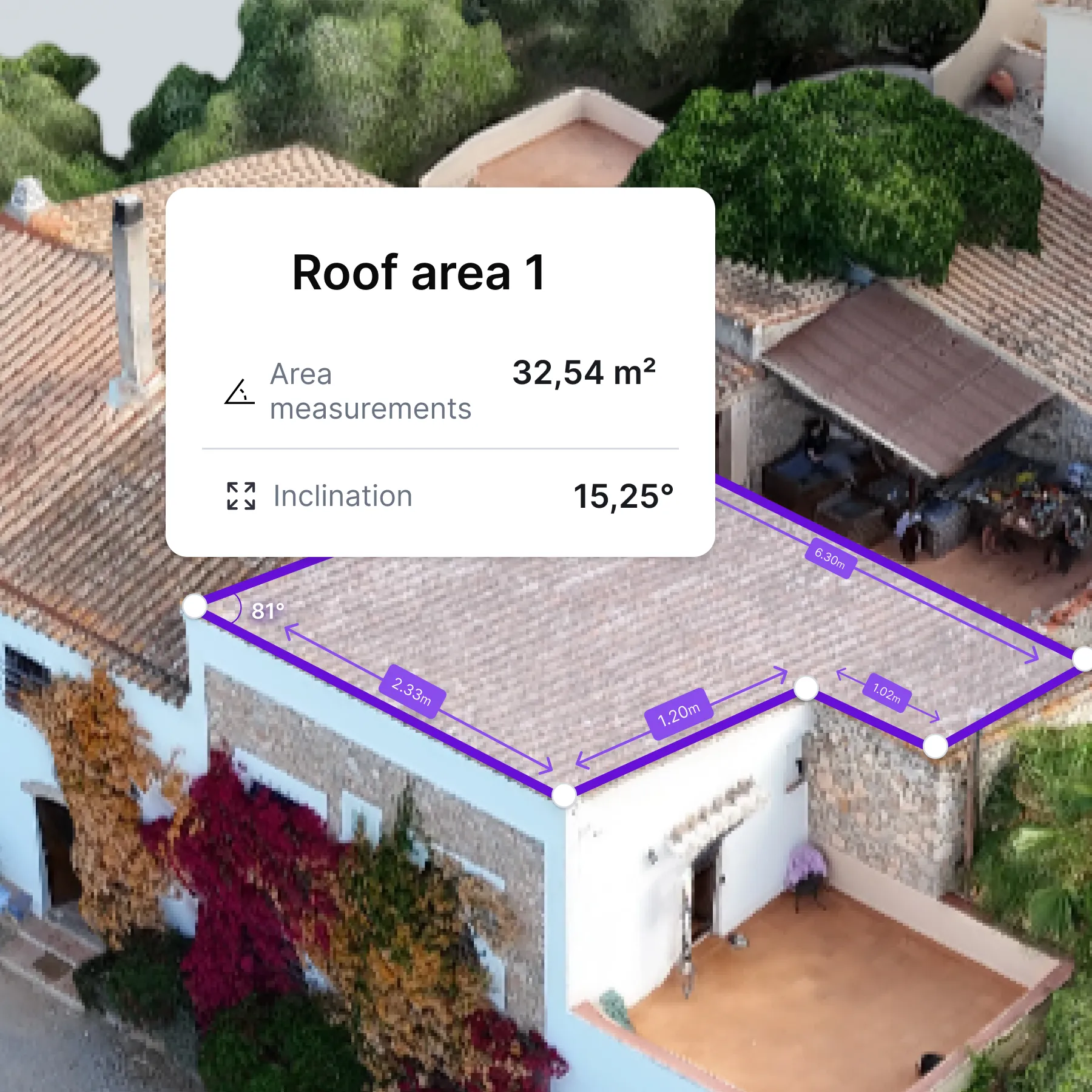
Precise measurement from images
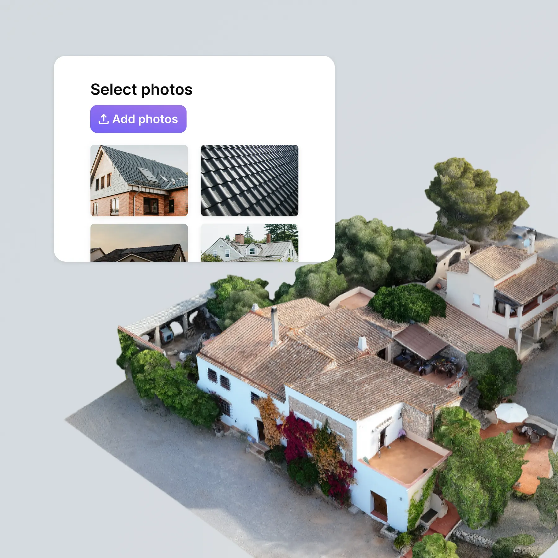
- Step 1: Carry out drone flight
- Step 2: Upload photos
- Step 3: Receive 3D model
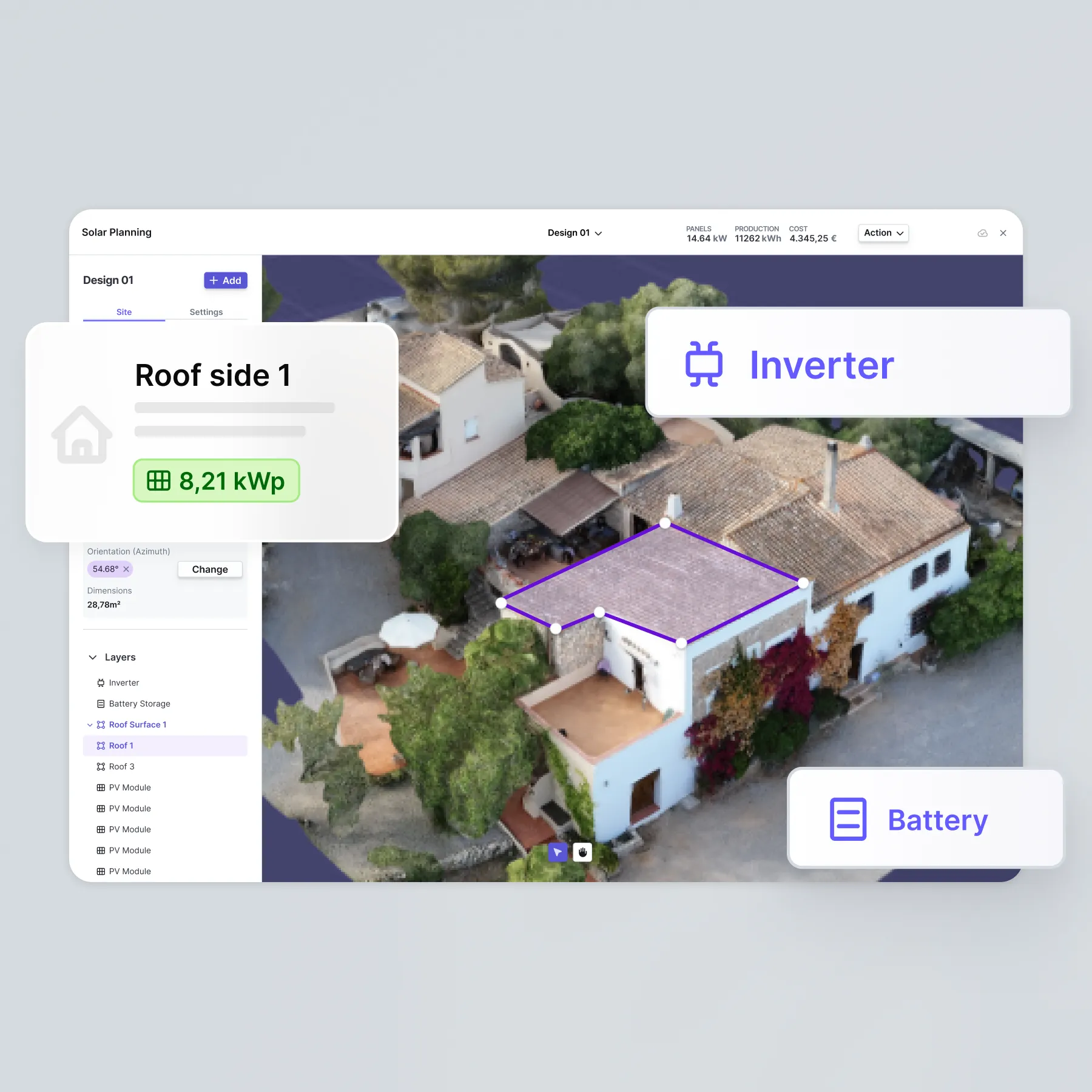
- Step 4: Plan PV system with autarc
Why you should use photogrammetry with autarc
- Everything from a single source: you don't need any additional software. The 3D model lands directly in autarc.
- Maximum safety: No more climbing onto the roof. No risk of accidents for your team.
- Precision to the centimetre: Measurement accuracy of 5 to 10 cm for reliable planning.
- Enormous time saving: 10-minute drone flight instead of hours of measuring.
- Professional impression: Impress customers with modern 3D visualisation.
- Seamless integration: Direct further use in PV planning without detours.
That's what you can expect

What is photogrammetry and how is it used?
Photogrammetry FAQ
Which photos do I need for photogrammetry?
Can I edit the model?
Can I also use the 3D model outside autarc?
How long does it take to process my drone photos?